California Titanic distance apart. That Titanic was heading north, with Californian on her port bow all night, puts Californian northwest of Titanic’s wreck site; and we have seen that this agrees with observations from the Californian which put the ship she saw at SSE by compass, which is about SE True from Californian. But how far northwest was she?
In the morning, when the breeze which sprang up with the dawn had dispersed the thermal inversion, restoring normal refraction, it was clear from the rescue ship Carpathia that the Californian was about 10 miles away. The Carpathia’s Second Officer, James Bisset, records the following on page 291 of his memoirs, “Tramps and Ladies”:
“While we had been picking up survivors, in the slowly increasing daylight after 4.30am, we had sighted the smoke of a steamer on the fringe of the pack ice, ten miles away from us to the northwards. She was making no signals, and we paid little attention to her, for we were preoccupied with more urgent matters; but at 6am we had noticed that she was under way and slowly coming towards us”. “When I took over the watch on the bridge of the Carpathia at 8am, the stranger was little more than a mile from us, and flying her signals of identification. She was the Leyland Line cargo-steamer Californian, which had been stopped overnight, blocked by ice.”

The SS Carpathia, which arrived at Titanic’s wreck site at 4am on the 15th of April 1912 and rescued all of Titanic’s 712 survivors © Topfoto Picture Library

The SS Mount Temple, saw the Californian and the Carpathia at dawn on 15th April 1912
© Sain-Patric Enright
And Bisset’s observation of the Californian being 10 miles north of Titanic’s wreck site until 6am on 15th April 1912 agrees with the following evidence of Captain Moore of the Mount Temple, who raced to Titanic’s distress position but found himself on the west side of the ice barrier which Titanic sank on the east side of:
JHM276. “…when I got the position in the morning I got a prime vertical sight; that is a sight taken when the sun is bearing due east. That position gave me 50⁰ 9 1/2′ west. [10 miles west of Titanic’s wreck site at 49.46W]
JHM 281. My fourth officer took two observations, and of course, he is a navigator, and also, an extra master’s certificate is held by him, which is a better certificate than mine, and he took those observations both times, and both of them tallied. One came 50⁰ 9 1/2′ west and the other came 50⁰ 9 3/4′. Of course, it proved afterwards when, after coming southward and trying to find some place I could get through, on the way back again – I suppose about 6 o’clock in the morning – that I sighted the Carpathia on the other side of this great ice pack, and there is where I understand he picked up the boats. So this great pack of ice was between us and the Titanic’s position.
JHM289. On which side of the ice pack was the Californian?
– The Californian was to the north, sir. She was to the north of the Carpathia…
JHM290. And you were also cut off from the Carpathia by this ice pack?
– Yes, sir; by this ice pack. He [Californian] was then north of the Carpathia, and he must have been, I suppose, about the same distance to the north of the Carpathia as I was to the westward of her.

Diagram showing relative positions of the Californian, Titanic and Mount Temple.
Californian had remained about 10 miles NW of Titanic since Titanic’s collision, as the two stopped ships had then drifted southward together in the Labrador Current. This position, 10 miles NW of Titanic’s wreck site at 41.43N 49.56W, put Californian at 41.51N 50.7W at 2.20am on 15th April 1912.
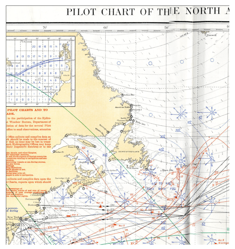
Pilot chart of the North Atlantic showing steamer tracks to New York and Boston, respectively. Where Titanic sank, these tracks are only thirteen miles apart.
This position for Californian, 10 miles NW of Titanic, is therefore confirmed as to direction by the eye witness evidence that night and as to distance by the eye witnesses evidence in daylight; and it also agrees with the navigational evidence.
Captain Lord of the Californian was aiming to make 42N in 51W, as Lord tells us in his 1959 Affidavit:
“On 14th April, the noon position by observation was 42° 05′ N., 47° 25′ W. [sic 47.34W – 25 miles was the departure distance from The Corner at 47W, where the almost 11 knot Californian was at 9.40am, so actual distance travelled at that latitude was 34 miles by noon], and course was altered to North 61˚ West (magnetic) to make due West (true) [sic S89W true]. I steered this course to make longitude 51˚ West in latitude 42˚ North on account of ice reports which had been received… Allowing S.89.W (true) 120 miles from my noon position…”
Lord: 6710. Where had you been heading before [you stopped for the night at 10.21pm]?
– S. 89, W. true.
This course and distance from Californian’s actual noon position would have brought Californian to a dead reckoning position of 42.2N 50.7W, 17 miles NNE from Titanic’s incorrect final distress position, which is where Lord told the Virginian he was, the next morning, according to Captain Gambel of the Virginian:
“She [the Californian] was 17 miles north of the Titanic, and had not heard anything official of the disaster. I sent a Marconigram to her as follows: “Titanic struck iceberg, wants assistance urgently, ship sinking, passengers in boats, her position lat. 41.46, long. 50.14.”
Lord confirms that he gave his position to Captain Gambel and the distance from Titanic’s incorrect distress position in a letter sent to the Board of Trade on August 10, 1912:
“April 15 about 6:30 am [sic 5.50am] gave my position to S.S. Virginian before I heard where the Titanic sunk, that also gave me 17 away.”
However, Captain Lord’s actual position was further south than he thought, because he had entered the south-going Labrador current just after his noon observation was taken, when Californian was in the same longitude as the Titanic was by 7pm, when she also entered the freezing water and Lightoller noticed the dramatic drop in temperature, when Titanic was in longitude 47.38W. Californian had therefore been set south by this current for almost 10.5 hours, before she came to a stop at 10.21pm, and for a further hour before Titanic’s collision and stop at about 11.40pm [about 11.30pm on Californian], when the two ships then drifted south together in the Labrador current.
This southerly set would not affect Lord’s dead reckoning longitude, which was therefore correct at 50.7W and we know that Californian was on a bearing of northeast from Titanic, which is 315 degrees true, and that the relative bearings of the two ships would not change appreciably whilst they drifted together, in the same current between Titanic’s collision at 11.40pm and sinking at 2.20am, which we now know was at exactly 41.43N 49.56W. A line northwest from this position, towards Californian, cuts the longitude 50.7W at 41.51N, 10 miles NW of Titanic and about 10 miles south of Lord’s 10.21pm real dead reckoning latitude of 42.2N. This 10miles difference in latitude from Lord’s Dead Reckoning latitude is not surprising, as Californian had been under the influence of the south-running Labrador Current for just over 14 hours by the time Titanic sank at 2.20am.
I hope by blogging chapters from my book, A Very Deceiving Night, it will contribute to the ongoing discussions regarding the atmospheric conditions on the night of the tragedy and the true causes of the disaster. At the moment, the book is only available as an e-book. If you wish to purchase it then you can do so in Amazon Kindle format here and other formats, including Apple, Kobo and Nook, here. Thank you.